View our location on Google Maps | Return to Website
These are turn-by-turn driving directions from the airport to the Villa.
Leaving the Cancun Airport just follow the signs to Playa del Carmen and/or Tulum on Highway 307. (Both of these cities are good places to stock up on food at any big box supermarket).
You will stay on this same Highway 307 for about three to three and a half hours. It is a divided highway through Tulum, and then it becomes a two-lane highway. After Tulum the road veers away from the coast and goes around the Sian Ka’an nature reserve. You’ll note the landscape change as you drive closer to the jungle. Stay on the same highway and follow the signs to Felipe Carillo Puerto and /or Chetumal. At Felipe Carillo Puerto you can either take a toll toad bypass or just go through the city. To drive through the city just keep going straight. You can get gas in this town and take advantage of the wonderful snacks that the locals sell at the gas station. If you have time, stop at the market there, as it is a good example of a traditional Mexican market. After Felipe Carillo Puerto you will drive about 45 minutes more to a very small town called Limones where there are usually people selling all kinds of fruit as you drive over the massive speed bumps.
VERY soon after Limones, about 4 kilometers, there is a turnoff to the left to go to Mahahaul. You should see a green overhead sign marking it. This road is called Carretera Cafetal-Mahahual. You will drive on this road for about 54 kilometers to get to Mahahual.
========
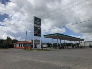
THE TURNOFF TO THE HOUSE IS BEFORE YOU REACH TOWN. First, you will see a turnoff to the RIGHT marked Xcalak. Shortly afterward you will see a PEMEX gas station on your right
========
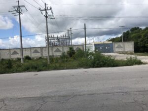
About 200 meters past the PEMEX station you will see an electrical station on your right. Make a LEFT turn when you see the electrical station. If you arrive at lighthouse then you have gone too far and need to turn around 🙂
========
After driving for just a few minutes you will see a turnoff for Puerto Bravo. Keep going STRAIGHT.
========
A few minutes later you will see a turnoff for Rio Indio. Keep going STRAIGHT.
========
A little longer and you will see a turnoff for El Placer. Keep going STRAIGHT.
========
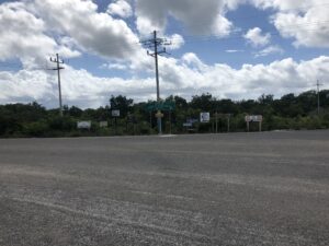
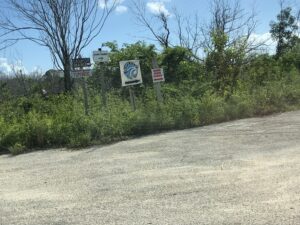
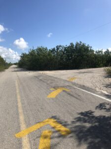
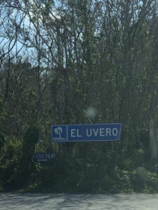
Shortly after you will see the following signs below marking the Uvero turnoff coming up soon. Once you reach it make a RIGHT turn. Notice the yellow arrows marking the turn 🙂
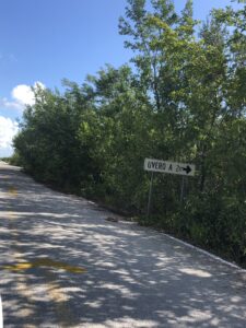
Uvero Turnoff
========
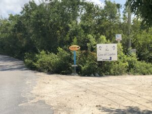
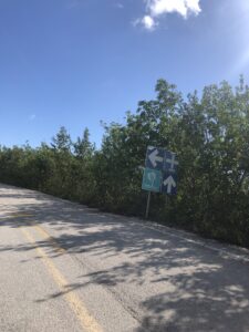
After turning right drive for 2 km and come to a T intersection where you will see this sign and make a LEFT.
========
You are now on what locals call the beach road or camino costero. It is a limestone gravel material called sascab that is generally smooth but can have some large, water-filled potholes depending on how long since the last grading of the road. You may also see vegetation encroaching up to half the road. You will drive for a few minutes and look on your right for this entrance to the house.
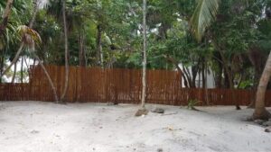
The Villa with gate closed
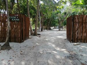
The Villa with gate opened
The caretakers Addiel and Zyed will greet you as you pull in and show you around the house.

Addiel and Zyed, the hosts for your trip.